PlatypusUSV
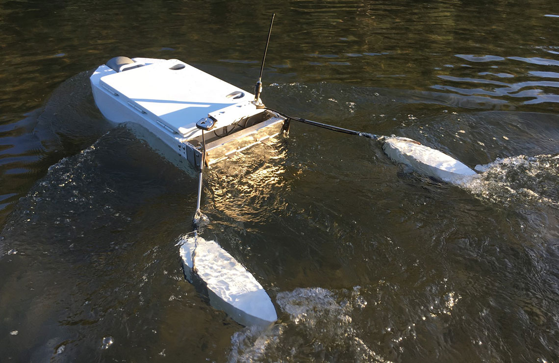
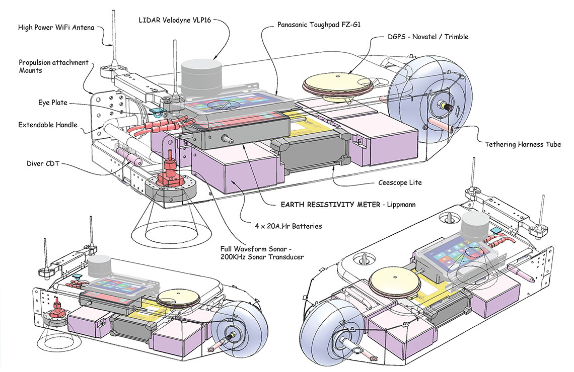
PlatypusUSV is an unmanned survey vessel we use for investigating earth irrigation infrastructure, rivers and lakes for connections between surface water and groundwater. It is a fully sealed durable utility watercraft designed for easy launch and retrieval from difficult and poorly maintained waterways.
Although PlatypusUSV is a utility vessel we offer the following specific utilizations as options:
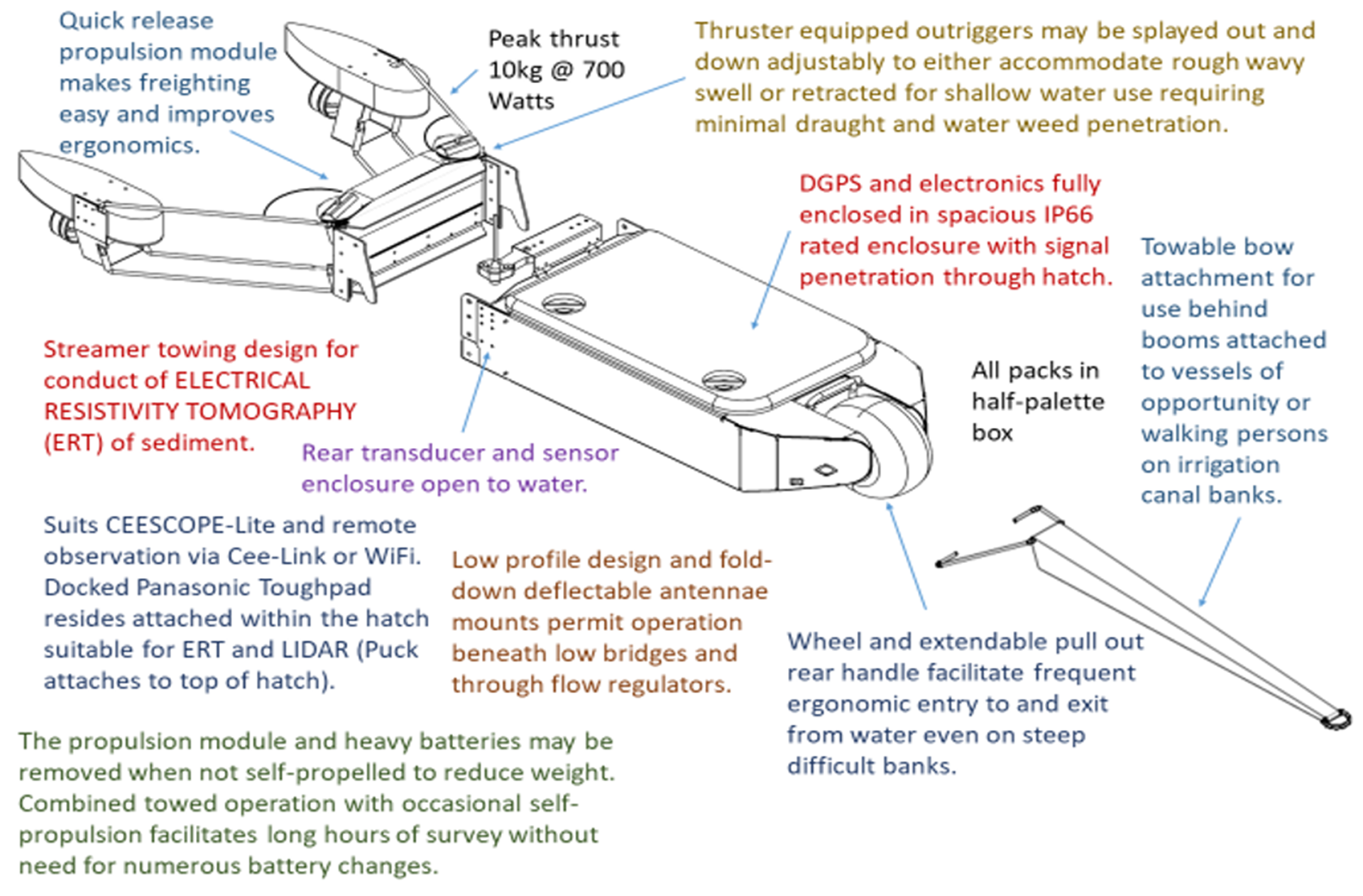
- Trawling electrical resistivity tomography streamers to image the substrate in layers to several meters beneath the bed. This is most effective for both mapping clay that seals infrastructure and for mapping saline inflow into rivers, lakes and drains. We call this application HERBI – Hydrographic Electrical Resistivity and Bathymetry Imaging. HERBI is also conducted from manned watercraft.
- Bathymetry. Either single beam or rotating beam sonar can be fitted with DGPS which fits up under a hollow in the plastic lid for extra protection.
- Water sampling.
- Manoeuvring permanent water sensor installations into position.
- Sludge characterization using full waveform sonar.
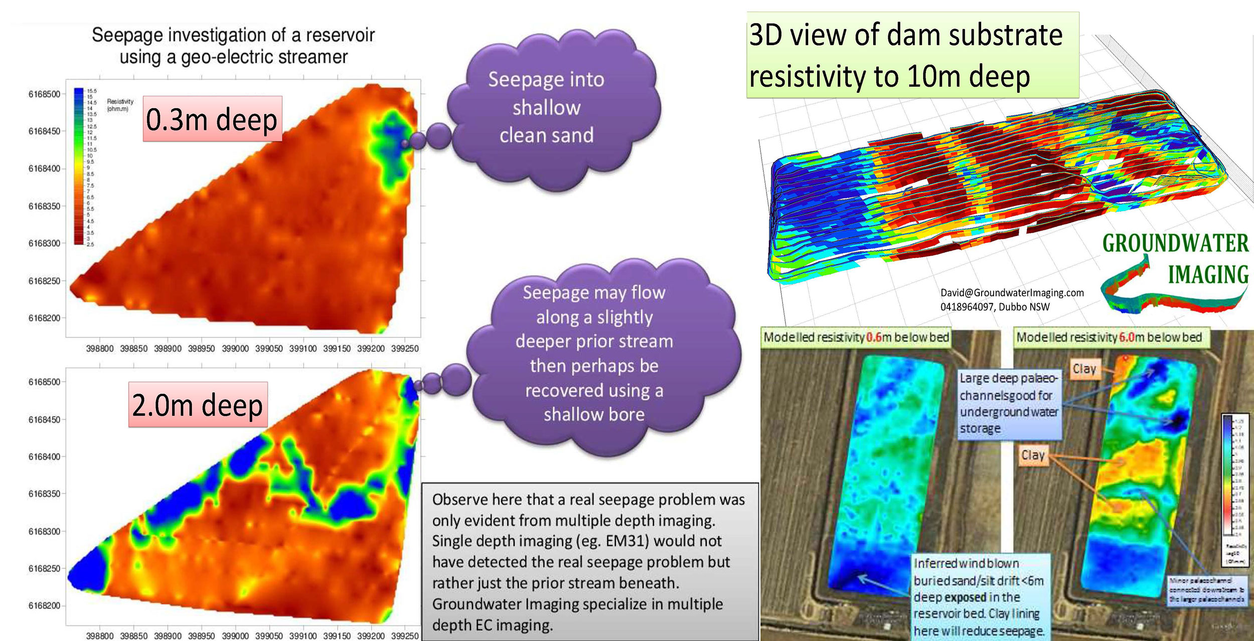
Find where water escapes from Dams - and then get it back again
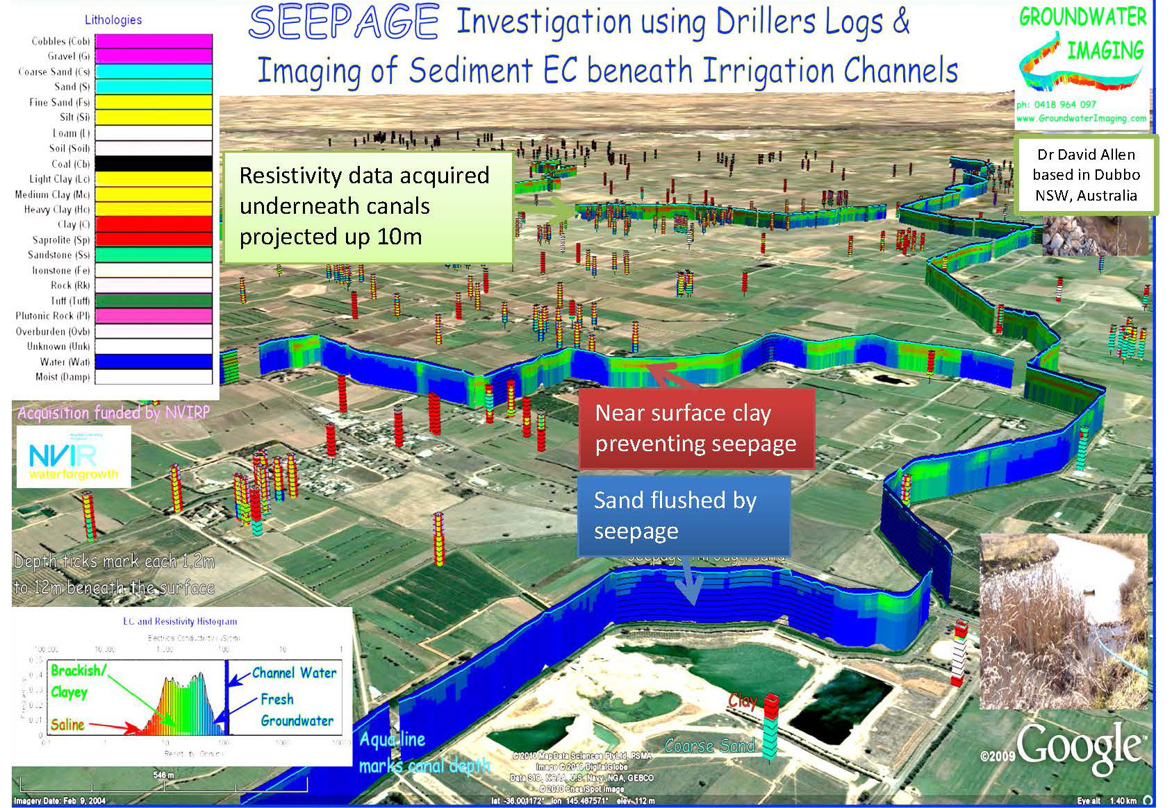
HERBI surveys of dams reveal seeps, and underground storage opportunities.
At the same time storage volume and surface area stage tables are generated so losses and stored volume can be measured by a reservoir gauging station.
Documents and Links
- A paper on Resistivity Imaging beneath a River: "Continuous electrical imaging for mapping aquifer recharge along reaches of the Namoi River in Australia"
- Water Borne Resistivity Imaging for Surface-groundwater Interaction (HERBI) and on-farm-based TEM Aquifer Mapping (AgTEM)
- Hydrographic Electrical Resistivity & Bathymetry Imagery